Majestic mountain views surround the San Luis Valley, located near the New Mexico border. Ski and art enthusiasts appreciate that Taos, New Mexico, is an easy 45 to 60 minutes south. Taos-popular for both its skiing and for its well-known art colony, attracting literally thousands of tourists each year-can become your own backyard playground. Other ski areas within 1 1/2 hour's drive offer beginner, intermediate, and pro slopes with snowboarding
areas.
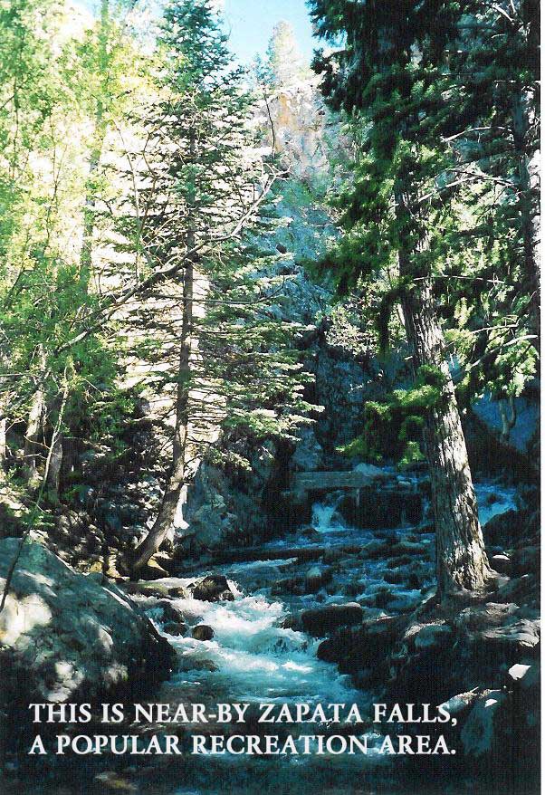
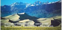
For more family recreation, there are several great options such as the Great San Dunes National Monument with camping, hiking, ATV trails, and majestic views. Zapata Falls, many horse trails, fishing and boating lakes such as Smith Reservoir -- stocked with trout, walleye and bass -- are within 45 minutes to an hour away. No less than four boating and fishing lakes are within 45 to 50 minutes.
The San Luis Valley has a well-deserved reputation as a sportsman's paradise. Herds of elk, deer and wild turkeys can be seen throughout the area. Residents can enjoy the rural serenity of the valley while having easy access to Alamosa ,to the northwest, where all the advantages of a four-year college, airport, and many shops and restaurants, including a new Wal Mart, are available. The Alamosa Tourism video posted on YouTube shows off the highlights of the San Luis Valley. Approximately 25 miles away, the town of San Luis is the oldest settlement in Colorado.
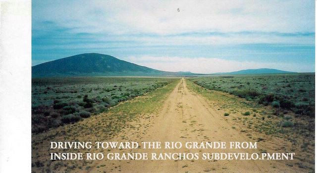
Home builders love that Rio Grande Ranchos remains unpolluted with a moderate cost of living. It sits on top of the largest, cleanest water table in the North American Continent. Its fertile soil produces a variety of crops, including an abundance of alfalfa. The sun shines an average of 300 days per year and snowfall is limited. Thanks to moderate weather and county-maintained roads, the land is accessible year round. Water rights are included with the property.
HUNTING, FISHING, SKIIING, CAMPING, SNOWMOBILING, BOATING, RV’S, HORSEBACK RIDING . . . . AND MORE.
To own your piece of paradise,
feel free to call or e-mail for more information.
CALL US: 805-407-3402
E-MAIL US: prosperitywest@pacbell.net
MORE ABOUT THE LOCATION
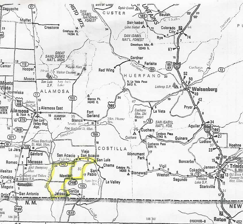
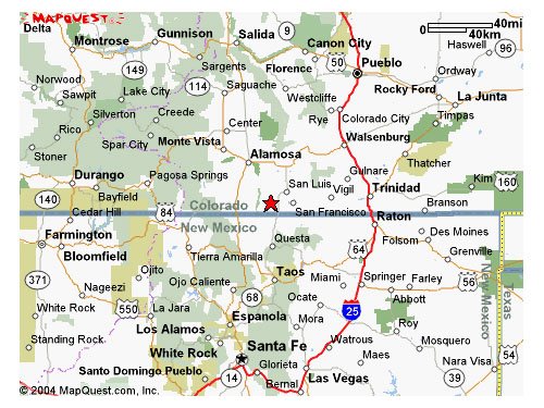
These Five-acre valley ranches and estates are located in Southern Colorado in Costilla County. The ranches and estates are near several communities; Ft. Garland, Blanca, Alamosa, Walsenburg, and Taos.New Mexico. The San Luis Valley is one of the world's largest and most breathtakingly beautiful mountain valleys. The Sangre De Cristo Mountains to the east, the San Juan Mountains to the west, and the La Garitas Mountains to the north surround the valley
ACCESSIBILITY: Your five-acre parcel can be reached year round by major highways found in the San Luis Valley and by county-dedicated roads.
CAMPING: Property owners may camp, park a trailer, or bring a camper to their estate site prior to building. A permanent residence building is not, however, a requirement of purchase. No one requires that you build anything at anytime
TAXES: Taxes and other governmental charges are approximately $62 for five-acre parcels. The payment of taxes is the property owner's responsibility. There are no special assessments or maintenance payments known or planned at this time, but taxes vary from parcel to parcel according to location.
UTILITIES: Propane gas service is available through several companies located in nearby towns and Alamosa. The Rural Electric Association (719- 852-3538 or 800-332-7634) has a San Luis Valley branch and provides electrical power to outlying areas, and property owners may obtain their own extensions depending on location. Service may also be supplied by the Public Service Company of Colorado. It is also possible, and may be desirable, to install a privately owned generator.
SEWER FACILITIES: There are no public sewer facilities within the five-acre valley ranches or estates and none planned or proposed. Private septic tanks or plants may be installed for individual parcels.
WATER: Individual wells may be drilled and have pumps of up to fifteen gallons per minute capacity, per five acres allowed.
TELEPHONE: Cellular phone service is available and phone lines vary in distance from the five-acre valley ranches and estates, according to location.
MEDICAL FACILITIES: Alamosa and Taos have excellent medical and dental facilities, plus a community hospital with complete medical and surgical facilities.
SCHOOLS: Colorado schools maintain a well-deserved national reputation. San Luis recently completed a new high school and also has primary and secondary schools. In addition, the cities of Blanca and Alamosa have primary and secondary schools. Alamosa is the home of Adams State College, a four-year, state-supported college. Colorado has a total of twnety-one universities and colleges offering training in literally every skill sought by business and
industry.
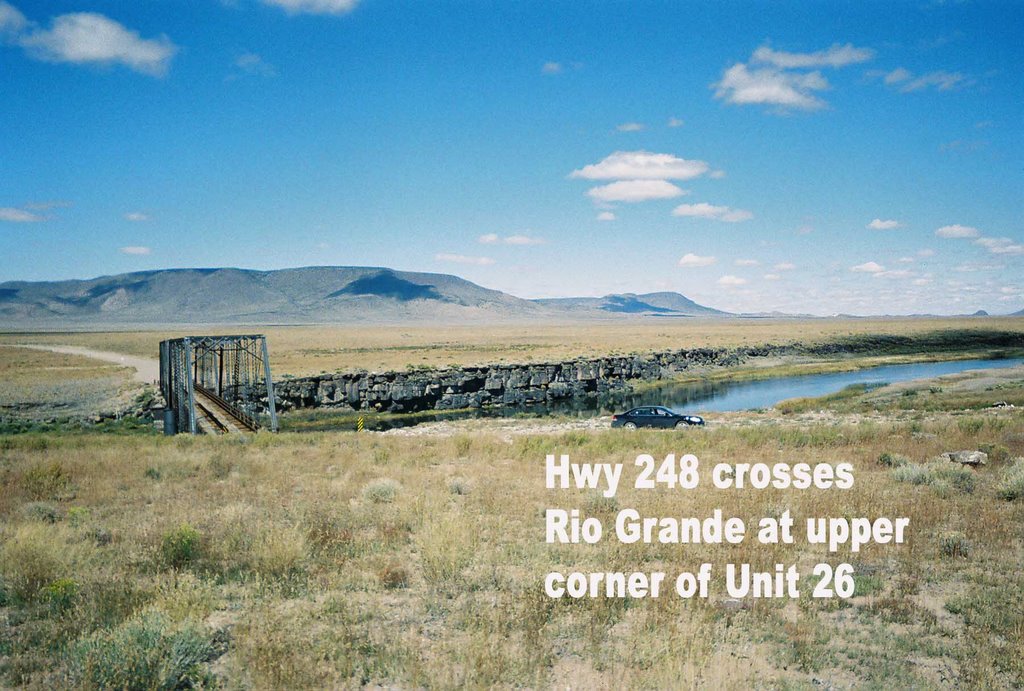
TRANSPORTATION: Numerous highways crisscross the San Luis Valley: U.S. 285 from north to south; U.S. 160 (the famed Navajo trail) from east to west; and Interstate 25 (linking Denver, Santa Fe, and Albuquerque). United Airlines (United Express) provides four scheduled flights per day to Alamosa Municipal Airport. Blanca and San Luis supply private airports. Greyhound Trailways bus lines serves Alamosa, Ft. Garland, Blanca, and Pueblo.
SHOPPING: The city of Alamosa has numerous stores, super markets, churches, hotels, and motels, movie theaters, bowling alleys, restaurants, and lounges, banks, savings and loans, and camping facilities. The town of Blanca has churches, a general store, a farm implement company, a post office, a cafe, restaurants, a lounge, and a fishing and hunting supply store.
OUTDOOR RECREATION: Colorado is an outdoor paradise for sportsmen and vacationers, presenting a panorama of recreation opportunities. The five-acre valley ranches and estates are surrounded by some of the best natural recreation available in America. More than one-third of Colorado's land has been reserved for public recreation, with hundreds of thousands of acres operated by the U.S. Forest Service, the Colorado State Land Board, and the Colorado Department of Game, Fish and Parks. Some nearby, nationally known parts and forest preserves include the San Isabel National Forest, the Rio Grande National Forest, and the Carson National Forest.
FISHING AREAS INCLUDE: Rio Grande River, Rio Grande Reservoir, Smith's Reservoir, Mountain Home Reservoir, Conejos River, Huerfano River, Continental Reservoir, Lathrop State Park, Platoro Reservoir, Road Canyon Reservoir, and Sanchez Reservoir.
WINTER SPORTS: Colorado has been called the country's winter recreation and ski center. A few of the ski areas most accessible from the five-acre valley ranches and estates are Monarch Pass, Wolf Creek Pass, Cucharas Pass, and Taos, New Mexico. Ice skating, tobogganing, and snowmobiling can also be enjoyed here. The closest ski area is Ski Rio, 30 miles from San Luis.
GOLF: Golf courses are located in Alamosa, Monte Vista, Walsenburg, and Taos.
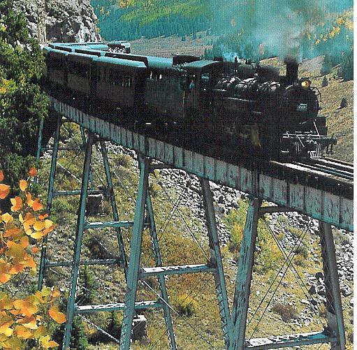
TOURIST ATTRACTIONS INCLUDE: Creed-Famous Gold-Mining Town; Crestone Needle; Cumbres Pass; Cumbres and Toltec Scenic Rail Road; Fort Garland (Home of Kit Carson); Great San Dunes National Monument; Kit Carson Creek; Kit Carson Trail; Manassa (Birthplace of Jack Dempsey, the Manassa Mauler); Monte Vista the Sky-Hi Stampede and Rodeo; Mount Blanca (14,325 Feet Elevation); Pike's Stockade; Platoro Reservoir; San Luis (Colorado's Oldest Town and first Spanish Mission); South Fork; Wheeler Monument (The Famed Priceless Pinnacles)
ELEVATION: The elevation is approximately 7,500 feet above sea level. The land lies on the floor of a large mountain valley with most of the land being level or gently sloping.
CLIMATE: The average precipitation is 6 1/2 inches. Winter brings less than 30 inches of snow. The average temperature in San Luis Valley ranges from 82 degrees to a low of 41 degrees during the summer. During the winter, the average temperature ranges from a high of 41 degrees and a low of 1 degree, with a mean temperature of 20 degrees.